“I am particularly excited to announce the long-awaited start of the Leaky Dams project in the Tas Valley, where we will be making and installing natural flood defences, using trees sourced from the immediate area to create barriers to slow down floodwaters in a measured way. There’s also more chances to learn the ancient craft of hedge laying at Easton College, restoring a historic pond to how it was in the 1930s (we have the photographic proof of that!) and plenty of hedge and fruit tree planting – including a new community orchard in Cringleford, and new and old sites to see across Broadland. Plus there’s another chance to see the epic Blickling Hall estate.”
Tim Hill again enlightens us on the birds to be seen on Marston Marsh. It is good to hear what he has to say about the scrapes. These were created recently as part of the work to reconnect the river with the marsh. The work had two main purposes, to improve the river’s ability to store water in times of flood, and to improve marshland wildlife habitat. There was concern about the effect of the heavy equipment used, but the surface scars are beginning to heal.
Here is Tim’s report:
A chiffchaff has decided not to migrate again and was “Chiffchaffing” into early December. Cetti’s warblers have been ever present and I recently discovered one that sounded like a great spotted woodpecker calling quietly. They are mobile but have been in the ditches either side of the central path running from the main entrance off Marston Lane (close to Abinger Way) to the river.
The new scrapes look very promising and are already attracting large numbers of black-headed gulls, with smaller numbers of herring and common gulls, all enjoying bathing in the winter afternoon sunshine. A heron has regularly opted to use the new fence around the pipe connecting the large scrape to the river as its favourite perch but has competition from the gulls and a kingfisher.
Gulls enjoying the Scrapes
November saw ducks regularly on the larger area of water at the east end and mallards have been joined by up to 4 gadwalls. The latter has only appeared here when the marsh has been in full flood before. Since November there has been a resident greylag goose that has wandered up and down between the new scrapes and has sometimes been joined by a small group of others. Pink-footed geese have been seen flying over, mostly in a SW direction, giving their classic “wink, wink” calls. They are usually seen around 8 am or soon after.
The bare earth at the west end was popular with corvids in late autumn. 100 were counted one afternoon being mostly crows and jackdaws but with a few rooks. The latter is a species that I have rarely seen on the ground here. Pied wagtails have also been seen on the ground around the new scrapes with a couple of visits by a grey wagtail flying over.
Large flocks of teal have visited in the last few weeks but have not landed. They usually come from the direction of Tesco, do a couple of circuits of the east end of the marsh and then return. Hopefully, now the wet area is much larger due to the recent rain, they might decide to settle on the water.
The “Marmite” species (ring-necked parakeet) seems to be thriving. The maximum number I have seen has been 30 and I am sure I missed a few. Without leaves on the trees, they ought to be easy to spot but that seems not to be the case. The best chance to count them is as they fly, as a flock, out from the poplars before returning to settle for the night.
The crows and magpies now have fewer perches to sit on as they wait for food to be placed on the gateposts at the east end of the boardwalk. At the beginning of December the large willow decided to shed about half of its branches with two large breaks, one either side of the main trunk.
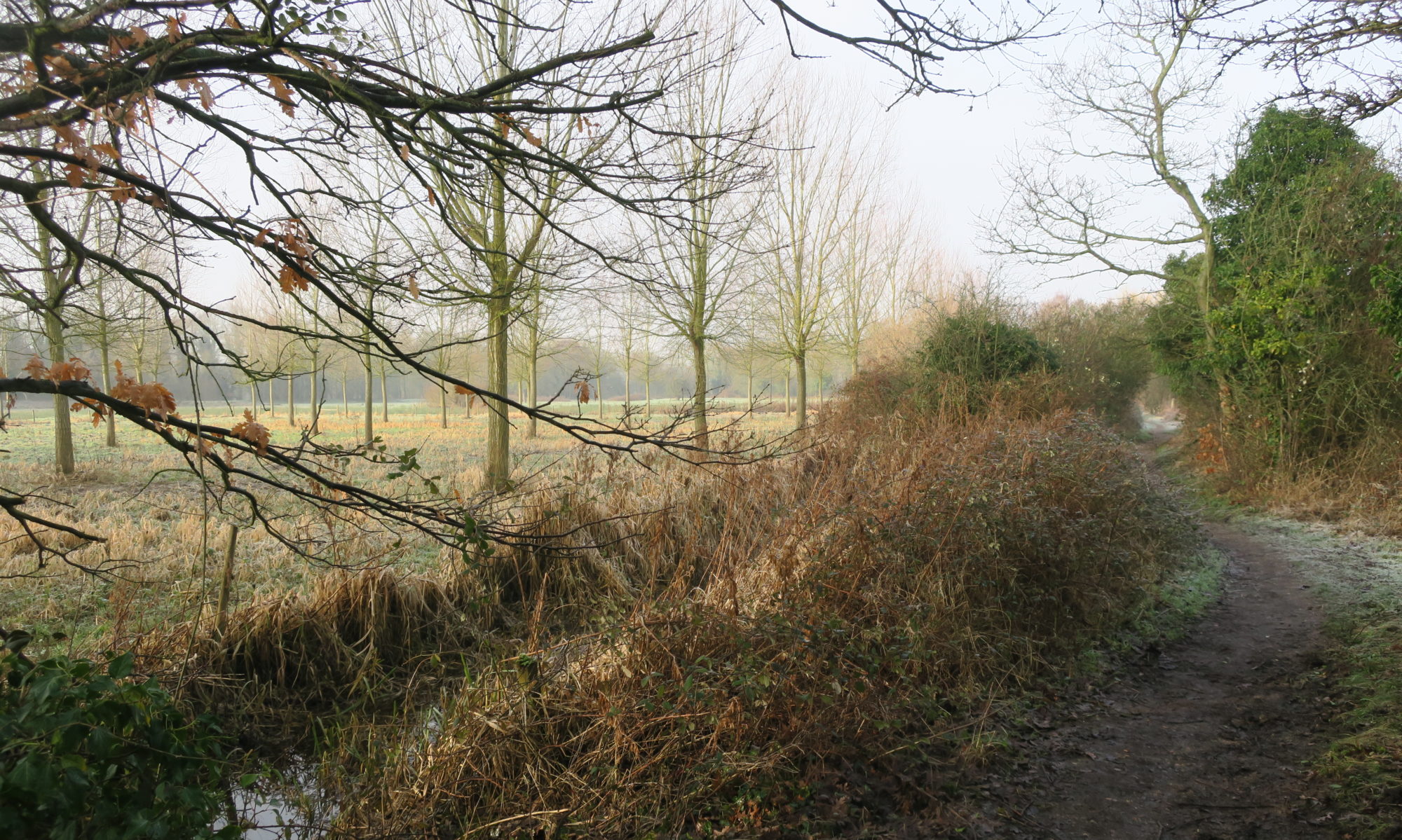
In the past century or so, many of our rivers, the Yare included, were canalised and disconnected from their flood plains. Attempts are now being made in a number of places to restore rivers closer to their former character. This is seen as having a number of advantages. Letting a river return closer to its natural state can create valuable wetlands, give time for sediment to settle, and reduce flooding downstream.
If you have been walking on Marston Marsh recently you will have seen and heard the activity on Keswick Marsh on the other side of the river. Here work is being done under the direction of the Norfolk Rivers Trust, in partnership with, and with funding from, the Environmental Agency (EA), Norfolk Water Strategy Programme and Anglian Water to improve wetland habitat on the floodplain. It includes reconnecting the floodplain to the river, improving the wet ditches, and creating wetland scrapes.
The large equipment being used is rather alarming, but assurances have been given that any damage done in the course of the work will be “mitigated”. The end result can have a number of positives, such as:
reducing the risk of flooding downstream. The flood plain will be more effective in storing floodwater and releasing it slowly. This should reduce the height of flood peaks downstream;
providing a greater range of habitat. This should increase biodiversity, increase resilience to climate change and better support natural ecological processes in the water network;
increasing the floodplain’s ability to store carbon and so reduce greenhouse carbon emissions.
Ignore it!
It is encouraging to see the effort being made to promote nature in the river valley.
Please help YVS to safeguard the Valley by responding to a consultation on the likely impact of installing pylons, solar panels, and other energy developments in the Yare Valley.
Pylons on Marston Marsh?
The Background
South Norfolk District Council is consulting on a draft Supplementary Planning Document (SPD) which deals with Landscape Susceptibility in relation to Energy Generation, Storage and Transmission as it relates to Local Character Areas* (LCAs) within its boundaries. It has drafted assessments of how susceptible the LCAs are to the development of solar photovoltaic panels, anaerobic digestion (AD) plants, battery storage facilities, overhead powerlines including 400kV lines that utilise the largest pylons (35-50m), underground cable routes, and substations. Among the LCAs assessed is LCA F1: Yare Valley Urban Fringe which is a part of South Norfolk that lies in the Yare Valley on the south side of the Norwich boundary (the river is the boundary).
The Yare Valley Society is concerned that the present draft susceptibility assessment in the consultation does not take fully into account the special circumstances of LCA F1. It is unique amongst the LCAs of South Norfolk, lying as it does in an urban fringe and forming part of the larger Yare Valley Green Infrastructure Corridor.
YVS is pressing for LCA F1 to have a special status and be included in the main body of the report under its own separate section. The YVS case for special status is here.
For a second submission to South Norfolk Council, YVS is preparing a detailed response to Appendix 3 Landscape Susceptibility Analysis of F1 (Pages 76 to 85). You might like to have a look at this and send in your comments to Planning at South Norfolk (email above).
Thank you for caring for the Valley
*Local Character Area status provides a degree of protection from inappropriate development. In the case of the Yare Valley LCA this is reflected in Policy DM 4.5 Landscape Character and River Valleys: “All development should respect, conserve and where possible, enhance the landscape character of its immediate and wider environment. Development proposals that would cause significant adverse impact on the distinctive landscape characteristics of an area will be refused. …”
Last year when Tim Hill reported in March on the birdlife he had seen on the marsh it was after the marsh had been under flood water for longer than is usual. This resulted in some new, or rare, wildfowl sightings and some common water birds appearing in larger numbers. Less flooding this year, and so there have been some changes. Tim Hill reports:
“The number of species seen each month, January to May, has been around 50. With winter visitors departing, and summer visitors arriving, a total of 73 different species has been seen so far this year. This is slightly lower at this stage than last year due to the flooding that occurred in February 2024 bringing in additional visitors that year.
Unusually for this species here, a chiffchaff overwintered along Marston Lane and was seen throughout January and February. It started singing in early March. They are now calling all round the perimeter of the marsh. Cetti’s warblers have been here continuously from March 2023 after disappearing for several years.
Another species seen more regularly during winter and spring is the greylag goose. For the second year a brood has hatched at the east end of the marsh, and they can often be seen on the south bank of the river with mum and dad standing guard as they feed.
The swans that previously nested where the river Yare joins the mill stream did not return to that nest site this year. There were issues for them last year caused by flooding. At the east end the pair that successfully raised a family last year has produced a brood of 6 cygnets this year.
The warblers are back in good numbers. Sedge warblers are setting up territories and displaying across the marsh. The scratchy song of whitethroats can be heard in most areas with bramble or nettle patches. There is a single reed warbler around the stile on Marston Lane. It has lately favoured calling near the new seat. A garden warbler has returned to the woods along the riverbank and is usually heard in the central area. There was a brief appearance of a grasshopper warbler, with its mechanical whirring, to the west of the central path from the lane to the river. Blackcaps are widespread and very vocal too. The first was heard at the end of March.
The parakeets seem to favour the eastern end of the marsh a bit more. They may be making use of the many holes in the trees at that end. They do still tend to roost, some evenings, in the poplars near the riverbank where they first appeared. A barn owl was seen regularly patrolling the whole marsh in January. It was out at almost any time during daylight hours, but I have not seen it since the beginning of February. A rare visitor to the marsh was a male marsh harrier in March. It patrolled quite low, on three occasions, showing its wonderful upper wing markings. Another rare visitor for the marsh was a great white egret. One pops in occasionally and is quite spectacular standing in the water at the edge of the river, with its long neck vertical, as it looks for food.
At the time of writing sand martins and swifts have been seen but house martins and swallows are yet to appear. Two other long-distance migrants have also arrived with a cuckoo seen near the boardwalk and a common tern hovering and diving along the river.”
Finally that oft seen sight on the look out for food:
UEA is moving forward with the support of the Yare Valley Society and other organizations to secure funding for the construction of a new boardwalk to replace the old worn out one.
Funding has now been obtained through the Norwich City Council for the design stage. UEA can now commission the boardwalk design and, if the City Council agrees the full project application is worth putting forward to the Greater Norwich Growth Board Infrastructure Investment Fund, UEA will submit the application in July 2025
Ahead of the design commissioning process, UEA are running two consultation sessions to hear from local organisations, community groups and schools about how the boardwalk could be restored and replaced in a way that makes the facility a more inclusive, welcoming and enjoyable space. The design will be community-informed, and so these consultations are an excellent opportunity to make suggestions and share ideas.
The consultations will take place on
Friday 9th May 9:30-11:30 [Venue: Roy Snelling Lecture Theatre, Bob Champion Building, NNUH. Free parking available.]
and
Tuesday 13th May 18:00-20:00 [Venue: Willow Centre, Round House Park. Free parking available.]
Yare Valley Society representatives will be at the Tuesday consultation.
Some of you have already noticed the felling of Crack Willows in Bowthorpe Southern Park. This is to provide materials to make the path from the Bridge of Dreams to Bowthorpe residences more resilient to the flooding that occurs regularly in the Park. At present the path is being seriously eroded. The willow will be used as edging on both sides of the path to slow the water down and prevent it from washing away the path. The willow logs will be fixed and laid in shallow trenches on both sides of the path.
The flood water is causing the most damage around the culvert pipes. This will be reduced by installing stone gabion baskets filled with reject flints, again to slow the water down, and reduce erosion of the path. The path will then be resurfaced with type one aggregate. This might look a bit harsh at first, but weather and nature will result in it softening into the landscape.
The work is being carried out by the Norwich Fringe Project and will start on Monday 28th April 2025.
Walkers in the Yare Valley have experienced inconvenience with the present extended period of flooding there has been in the valley, but this is nothing compared with the devasting effect it can have on the valley ecosystem. The wildlife of the valley has experienced repeated flooding in the past, and so can be expected to have a degree of resilience in flood conditions, but the recent flooding has continued for an unusually long time. Flooding impacts on both flora and fauna, destroying habitats, drowning wildlife, and spreading disease. It also changes the balance of species to be seen in the valley.
No way for walkers Photo: Tim Hill
Tim Hill has been out and about on Marston Marsh, and reports on some of the ornithological changes:
“Much of the marsh has been under water for longer than is usual resulting in some new, or rare, wildfowl sightings and some common water birds appearing in larger numbers. In the middle of February black-headed gulls reached a peak number of about 50 along the western half of the river. In amongst them were 3 or 4 common gulls, several herring gulls and the first of the lesser black-backed gulls to arrive. The number of greylag geese gradually increased through February reaching 43 on the 28th of the month. The number has since decreased to single figures since then. This larger number also attracted a couple of Canada geese, a rare sight here. There have been up to three Egyptian geese, with a lone goose staying very close to the boardwalk most of the time. Opposite the seat by the river, at the western end, two oystercatchers have been a regular feature since 17th of February into March. In the same area teal and gadwall have also been seen. On 18th of February there was a single wigeon, on the flood, north of the rail crossing onto the south side of the river. This is the first I have seen here. On the 21st of February there were 3 tufted ducks, on the flooded area, to the south of the stile along Marston Lane. This is also a new species for my marsh list. Three gadwall appeared there a few days later. Little grebes have been heard calling, regularly throughout February, from the flooded areas north of the river and close to the lane. The number of little egrets has peaked at 5.
Waterbirds welcome Photo: Tim Hill
Bullfinches have returned to the blackthorn bushes to the west of the stile and a stonechat has reappeared to the west of the outflow by the swings. There has been a vocal water rail in the ditch alongside Marston Lane, about halfway between the entrance to the marsh from Abinger Way and the stile. Stock doves have been regularly seen on or around the owl box but may be competing with grey squirrels for its occupancy. At the beginning of March there were about 50 siskins in the trees around the bridge at the east end. Redwings have been around in small numbers, but I have not seen a fieldfare here this year.”
In recent days the Yare Valley has again been fulfilling two of its major roles in combating climate change: mitigating its effects and providing resilience. Its marshes, commons and meadows have become storage basins for many cubic metres of flood water slowing down its rush to the sea and lessening the chance of inundation of properties downstream.
Marsden Marsh from Marsden Lane seat. Photo: John Elbro
We have been deprived of some of our favourite walks, but it is a small price to pay. As compensation there are dramatic views to enjoy. Other obstructions to paths have been fallen trees after storm Henk, but normally a way can be found round or over these.
Bridleway to Keswick Mill from Church Lane. Photo: John ElbroFallen Tree on path to river from Strawberry Field. Photo: Paul Hann
The depth water on the bridleway was over welly height and rising!
The attenuation basins constructed under the supervision of the Norfolk Rivers Trust below the Strawberry Field have been inundated. As the waters recede the basins will retain water to increase the resilience of the marsh in times of drought and so help safeguard the habitats of water voles and other wildlife.
Inundated attenuation ponds below Strawberry Field. Photo: Paul Hann
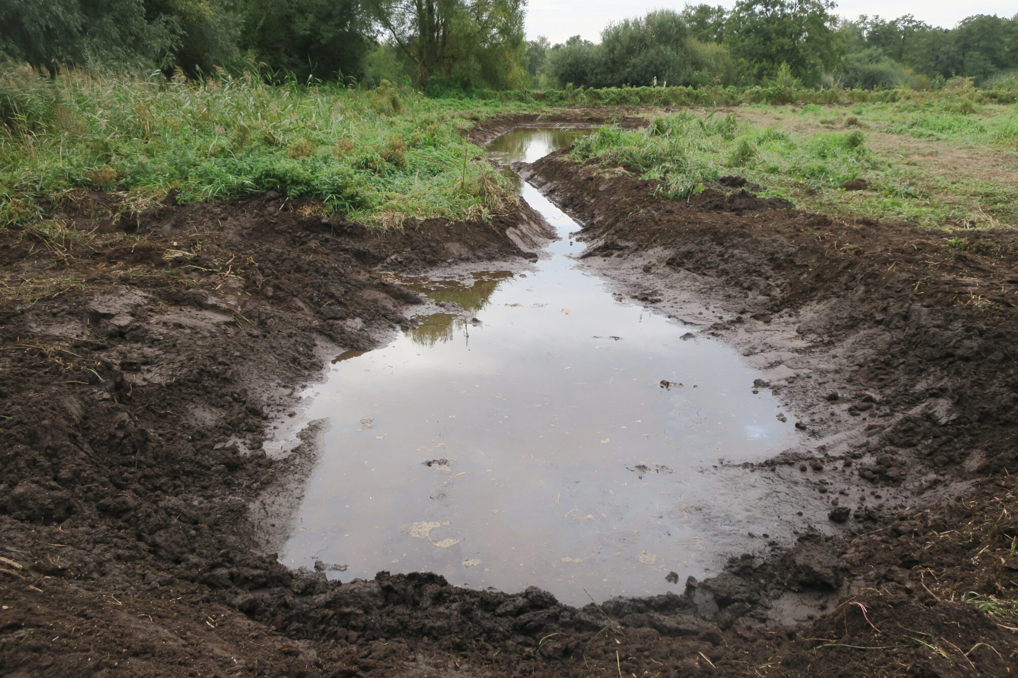
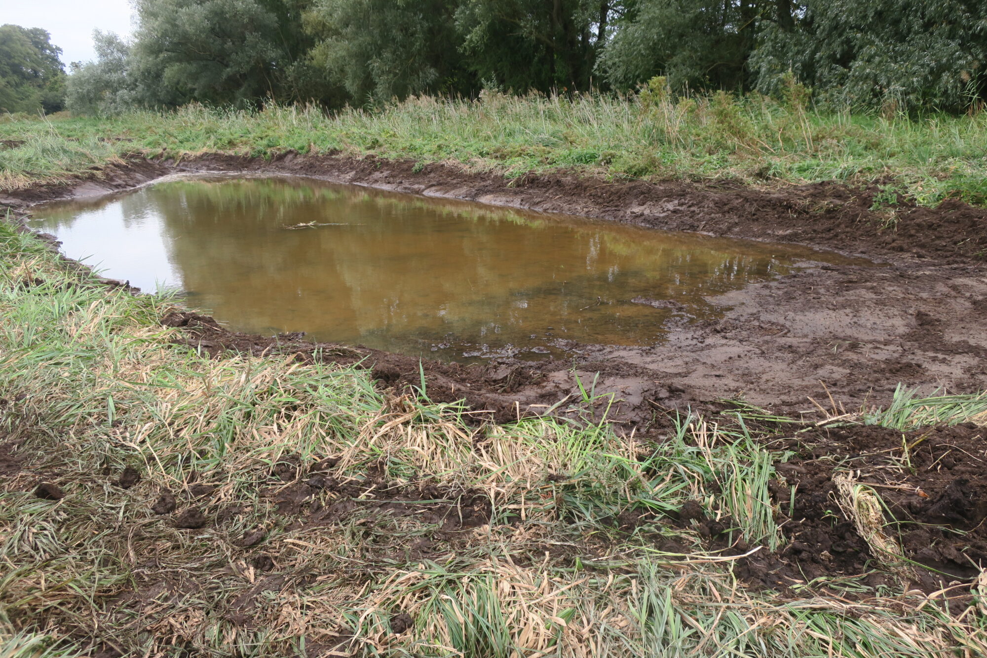
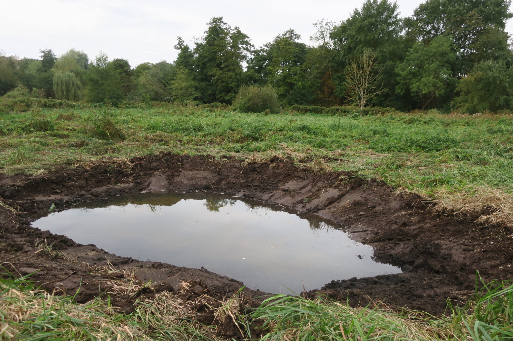
Norfolk Rivers Trust have been overseeing work on the wetlands between the Strawberry Field and the river. The aim is to make the wetlands more resilient to climate change. Recent extended droughts have resulted in some of the wetland peat drying out, with release of carbon dioxide, and an adverse effect on flora and fauna. Pools are being created to store more water in time of flood, the water then being available during dry periods.
In the foreground is a stilling pool. This is deep enough to reduce the velocity or turbulence of the water flowing into the pool system and encourage sedimentation prior to the water entering the main pool. The channel leads to the main water storage pool.
The channel enters the storage pool on the left. The other end of the storage pool is sloping to encourage a variety of flora and fauna habitat.
Nearby a scrape has also been created. Scrapes are shallow ponds of less than 1m depth with gently sloping sides. They hold rain or flood water seasonally and, hopefully, will remain damp for most of the year.
It all looks rather stark at the moment, but it will not be long before nature takes advantage of the opportunities offered, and all will assume a softer natural appearance.
The changes will be monitored by the Norfolk Rivers Trust to see how effective they are in reducing the drying out of the wetland. The Trust has further projects in hand to improve the effectiveness of the Yare Valley as a wildlife corridor.