Last year when Tim Hill reported in March on the birdlife he had seen on the marsh it was after the marsh had been under flood water for longer than is usual. This resulted in some new, or rare, wildfowl sightings and some common water birds appearing in larger numbers. Less flooding this year, and so there have been some changes. Tim Hill reports:
“The number of species seen each month, January to May, has been around 50. With winter visitors departing, and summer visitors arriving, a total of 73 different species has been seen so far this year. This is slightly lower at this stage than last year due to the flooding that occurred in February 2024 bringing in additional visitors that year.
Unusually for this species here, a chiffchaff overwintered along Marston Lane and was seen throughout January and February. It started singing in early March. They are now calling all round the perimeter of the marsh. Cetti’s warblers have been here continuously from March 2023 after disappearing for several years.
Another species seen more regularly during winter and spring is the greylag goose. For the second year a brood has hatched at the east end of the marsh, and they can often be seen on the south bank of the river with mum and dad standing guard as they feed.


The swans that previously nested where the river Yare joins the mill stream did not return to that nest site this year. There were issues for them last year caused by flooding. At the east end the pair that successfully raised a family last year has produced a brood of 6 cygnets this year.

The warblers are back in good numbers. Sedge warblers are setting up territories and displaying across the marsh. The scratchy song of whitethroats can be heard in most areas with bramble or nettle patches. There is a single reed warbler around the stile on Marston Lane. It has lately favoured calling near the new seat. A garden warbler has returned to the woods along the riverbank and is usually heard in the central area. There was a brief appearance of a grasshopper warbler, with its mechanical whirring, to the west of the central path from the lane to the river. Blackcaps are widespread and very vocal too. The first was heard at the end of March.
The parakeets seem to favour the eastern end of the marsh a bit more. They may be making use of the many holes in the trees at that end. They do still tend to roost, some evenings, in the poplars near the riverbank where they first appeared. A barn owl was seen regularly patrolling the whole marsh in January. It was out at almost any time during daylight hours, but I have not seen it since the beginning of February. A rare visitor to the marsh was a male marsh harrier in March. It patrolled quite low, on three occasions, showing its wonderful upper wing markings. Another rare visitor for the marsh was a great white egret. One pops in occasionally and is quite spectacular standing in the water at the edge of the river, with its long neck vertical, as it looks for food.
At the time of writing sand martins and swifts have been seen but house martins and swallows are yet to appear. Two other long-distance migrants have also arrived with a cuckoo seen near the boardwalk and a common tern hovering and diving along the river.”
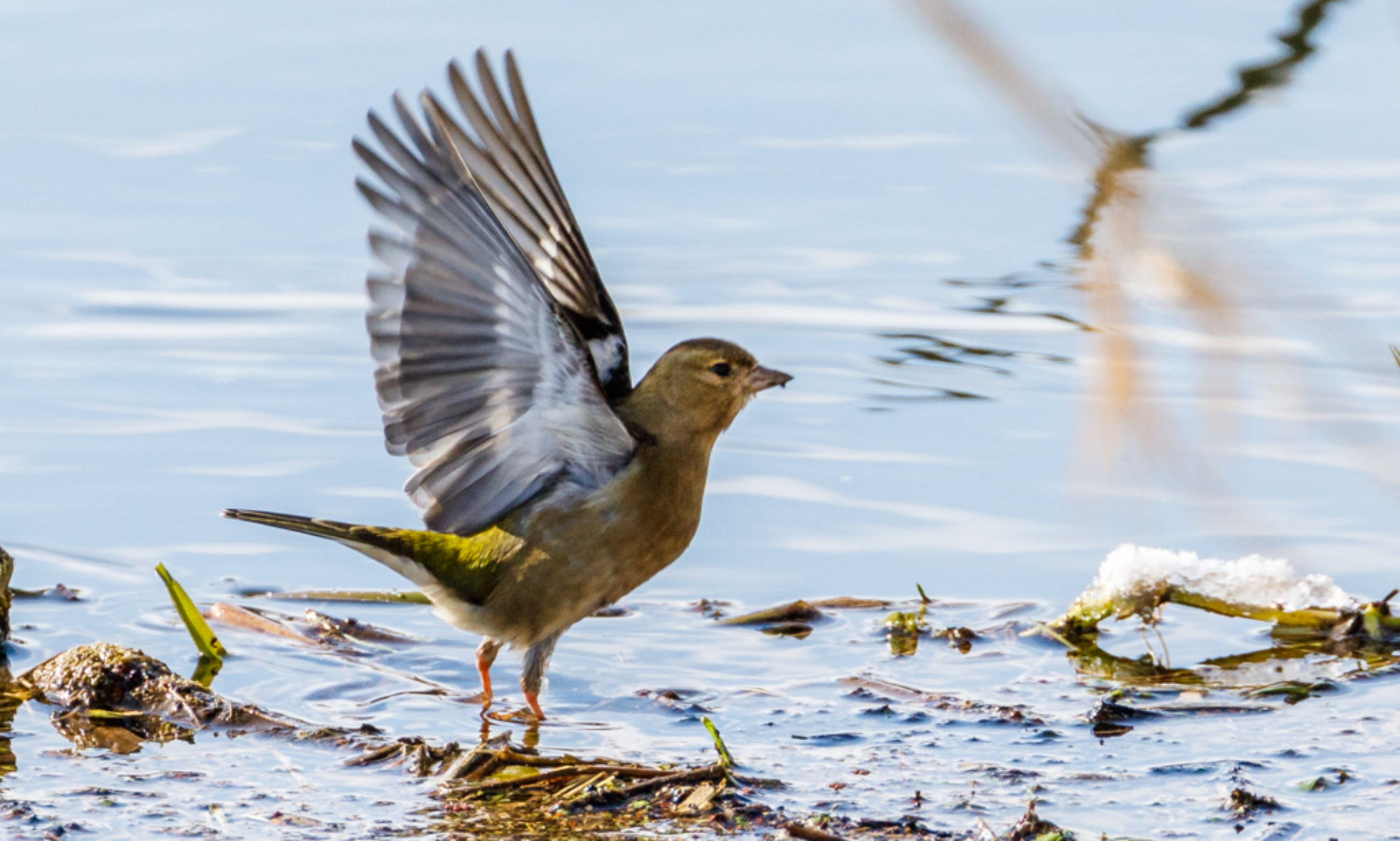
Finally that oft seen sight on the look out for food:

All photos by Tim Hill.


