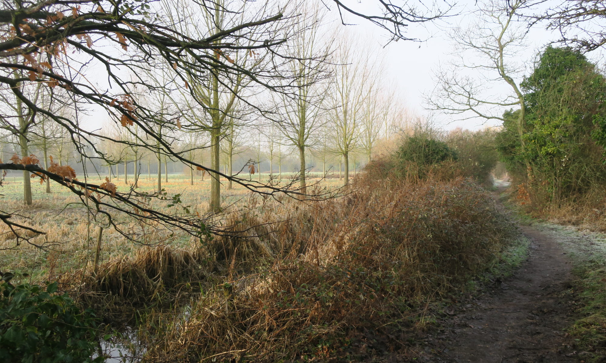
The Yare Valley Meadow Makers (YVMM) invite you to join with them and the UEA Biodiversity Heroes in planting trees in the university meadow.
Matt Tomlinson (centre of photo) of the YVMM writes:
“To beat the winter blues we have a winter work party planned, joining with UEA biodiversity heroes.
We are planting trees on the UEA meadows. For more shade (better able to cope with droughts), increased habitat diversity and linking together the wooded habitats on campus and lake sides. As well as providing an excellent habitat in their own right. Species are wild pear, spindle, hazel, blackthorn, rowan and wych elm. All excellent for wildlife, kindly supplied by the council and UEA.
[Come along at] 9-12am on Wednesday 11th February, meet at the new sign [in the photo] on the UEA meadow, if you are a little late please walk down the meadows to find us.”
YVMM hope to have another work party in late February, this time planting trees supplied by the Woodland Trust.
Tim Hill again enlightens us on the birds to be seen on Marston Marsh. It is good to hear what he has to say about the scrapes. These were created recently as part of the work to reconnect the river with the marsh. The work had two main purposes, to improve the river’s ability to store water in times of flood, and to improve marshland wildlife habitat. There was concern about the effect of the heavy equipment used, but the surface scars are beginning to heal.
Here is Tim’s report:
A chiffchaff has decided not to migrate again and was “Chiffchaffing” into early December. Cetti’s warblers have been ever present and I recently discovered one that sounded like a great spotted woodpecker calling quietly. They are mobile but have been in the ditches either side of the central path running from the main entrance off Marston Lane (close to Abinger Way) to the river.
The new scrapes look very promising and are already attracting large numbers of black-headed gulls, with smaller numbers of herring and common gulls, all enjoying bathing in the winter afternoon sunshine. A heron has regularly opted to use the new fence around the pipe connecting the large scrape to the river as its favourite perch but has competition from the gulls and a kingfisher.
Gulls enjoying the Scrapes
November saw ducks regularly on the larger area of water at the east end and mallards have been joined by up to 4 gadwalls. The latter has only appeared here when the marsh has been in full flood before. Since November there has been a resident greylag goose that has wandered up and down between the new scrapes and has sometimes been joined by a small group of others. Pink-footed geese have been seen flying over, mostly in a SW direction, giving their classic “wink, wink” calls. They are usually seen around 8 am or soon after.
The bare earth at the west end was popular with corvids in late autumn. 100 were counted one afternoon being mostly crows and jackdaws but with a few rooks. The latter is a species that I have rarely seen on the ground here. Pied wagtails have also been seen on the ground around the new scrapes with a couple of visits by a grey wagtail flying over.
Large flocks of teal have visited in the last few weeks but have not landed. They usually come from the direction of Tesco, do a couple of circuits of the east end of the marsh and then return. Hopefully, now the wet area is much larger due to the recent rain, they might decide to settle on the water.
The “Marmite” species (ring-necked parakeet) seems to be thriving. The maximum number I have seen has been 30 and I am sure I missed a few. Without leaves on the trees, they ought to be easy to spot but that seems not to be the case. The best chance to count them is as they fly, as a flock, out from the poplars before returning to settle for the night.
The crows and magpies now have fewer perches to sit on as they wait for food to be placed on the gateposts at the east end of the boardwalk. At the beginning of December the large willow decided to shed about half of its branches with two large breaks, one either side of the main trunk.
Please write now to your MP to give your strong support to the Lord’s amendments to the Planning and Infrastructure Bill 94 and 130 due for imminent consideration.
The Green Infrastructure Corridor provided by the Yare Valley on the edge of South Norwich has important roles in promoting wildlife, limiting and combatting climate change, and as being a place for informal recreation for Norwich residents and beyond. Both of these amendments are importance to safeguard the well-being and continued existence of the Corridor.
The river Yare is one of the globally rare chalk streams capable of sustaining a rich and varied wildlife. Amendment 94 should help to safeguard these precious chalk streams, a responsibility we as individuals, but also as a nation, have towards the retaining this character of wildlife habitat in the world.
Amendment 130 should help to safeguard the Valley’s wildflower meadows and woodlands. Much work has been done in the Valley to improve both in recent years, thanks to the efforts of many volunteers including those with Yare Valley Meadow Makers, the Norwich Fringe Project, the Conservation Volunteers, and, joined most recently, by the UEA Biodiversity Heroes. This effort and goodwill in enhancing the Valley must not be threatened by development that does not properly recognise the value of green space for maintaining human and wildlife well-being.
Either email your MP directly of make use of the Wildlife Trusts website to forward your email.
In the past century or so, many of our rivers, the Yare included, were canalised and disconnected from their flood plains. Attempts are now being made in a number of places to restore rivers closer to their former character. This is seen as having a number of advantages. Letting a river return closer to its natural state can create valuable wetlands, give time for sediment to settle, and reduce flooding downstream.
If you have been walking on Marston Marsh recently you will have seen and heard the activity on Keswick Marsh on the other side of the river. Here work is being done under the direction of the Norfolk Rivers Trust, in partnership with, and with funding from, the Environmental Agency (EA), Norfolk Water Strategy Programme and Anglian Water to improve wetland habitat on the floodplain. It includes reconnecting the floodplain to the river, improving the wet ditches, and creating wetland scrapes.
The large equipment being used is rather alarming, but assurances have been given that any damage done in the course of the work will be “mitigated”. The end result can have a number of positives, such as:
reducing the risk of flooding downstream. The flood plain will be more effective in storing floodwater and releasing it slowly. This should reduce the height of flood peaks downstream;
providing a greater range of habitat. This should increase biodiversity, increase resilience to climate change and better support natural ecological processes in the water network;
increasing the floodplain’s ability to store carbon and so reduce greenhouse carbon emissions.
Ignore it!
It is encouraging to see the effort being made to promote nature in the river valley.
Please help YVS to safeguard the Valley by responding to a consultation on the likely impact of installing pylons, solar panels, and other energy developments in the Yare Valley.
Pylons on Marston Marsh?
The Background
South Norfolk District Council is consulting on a draft Supplementary Planning Document (SPD) which deals with Landscape Susceptibility in relation to Energy Generation, Storage and Transmission as it relates to Local Character Areas* (LCAs) within its boundaries. It has drafted assessments of how susceptible the LCAs are to the development of solar photovoltaic panels, anaerobic digestion (AD) plants, battery storage facilities, overhead powerlines including 400kV lines that utilise the largest pylons (35-50m), underground cable routes, and substations. Among the LCAs assessed is LCA F1: Yare Valley Urban Fringe which is a part of South Norfolk that lies in the Yare Valley on the south side of the Norwich boundary (the river is the boundary).
The Yare Valley Society is concerned that the present draft susceptibility assessment in the consultation does not take fully into account the special circumstances of LCA F1. It is unique amongst the LCAs of South Norfolk, lying as it does in an urban fringe and forming part of the larger Yare Valley Green Infrastructure Corridor.
YVS is pressing for LCA F1 to have a special status and be included in the main body of the report under its own separate section. The YVS case for special status is here.
For a second submission to South Norfolk Council, YVS is preparing a detailed response to Appendix 3 Landscape Susceptibility Analysis of F1 (Pages 76 to 85). You might like to have a look at this and send in your comments to Planning at South Norfolk (email above).
Thank you for caring for the Valley
*Local Character Area status provides a degree of protection from inappropriate development. In the case of the Yare Valley LCA this is reflected in Policy DM 4.5 Landscape Character and River Valleys: “All development should respect, conserve and where possible, enhance the landscape character of its immediate and wider environment. Development proposals that would cause significant adverse impact on the distinctive landscape characteristics of an area will be refused. …”
In the past year or so, representatives from the Yare Valley Society have participated in consultations and workshops to guide the formulation of a new updated Green Infrastructure Strategy for Greater Norwich for up to 2038. The Greater Norwich Growth Board has now approved the Strategy and this month YVS representatives attended its official launch at the Sainsbury Centre at UEA.
UEA Iris has a visitor Photo: Rachel Taylor
The Strategy focuses on “delivering multiple benefits: nature-rich places, active and healthy communities, thriving economies, improved water management, and resilient climate-positive environments. … [It is] … a significant milestone, which paves the way for a greener, more connected Greater Norwich.”
For an overall view of the entire Strategy go to Greater Norwich Green Infrastructure Strategy Story Map.
You can explore the hoped for outcomes of the Strategy by going to the Strategy Documents and selecting the Strategic Delivery Plan 2025-2030 and look at the Proposed Strategic Green Infrastructure Initiatives in its Delivery Programme.
This news item will focus on the initiatives that relate to the key role the Yare Valley has in the Strategy as a Strategic Green Infrastructure (GI) Corridor.
Reproduced by kind permission of the Greater Norwich Growth Board
The Yare Valley Society has long pressed for the Valley Corridor to be regarded as a single entity in planning, and this long held vision is promoted in the “Southern Norwich Yare Valley Parkway” initiative. The initiative will “encourage projects that support development of a major linear park connecting a potential new country park at Bawburgh and Colney Lakes west of Norwich with Whitlingham Country Park to the east, including completion of the Yare Valley Walk and improved links to the city centre, as well as potential links to the Wensum Corridor in Norwich and to the west, and restoration of floodplain fen habitats and riparian woodland along the river corridor”
Other initiatives indicate how the Parkway is to be embedded in the wider green infrastructure.
The Parkway will be linked to the “Norwich Green Grid Corridors” initiative. The initiative will “encourage projects that support enhancement of Green Grid Corridors within the densely built-up Norwich Urban Area, creating a strong and multifunctional green network connecting Norwich to the wider strategic GI network – through access improvements, including new/enhanced green spaces and waterside access, urban greening, food growing spaces, protecting and enhancing wildlife sites, and enhancing the City’s landscape setting (including wooded valley sides and ridgelines in particular)”
The Parkway will also link via green corridors to the Wensum Valley, to the surrounding country towards Wymondham and towards the Waveney Valley Strategic Green infrastructure corridor.
The “South Norwich to the Waveney Valley” initiative will “encourage projects that support enhancement of the Boudicca Way between Norwich and Diss including as access improvements and creating new circular walks linked to the Norfolk Trails network to align with the Norfolk Access Improvement Plan 2019–2029, and improved connectivity and enhancement of hedgerows and woodland habitats.”
The South-West Norwich to Wymondham will “encourage projects that support enhancement of the Strategic GI Corridor linking South-West Norwich with Wymondham including new and improved accessible greenspace, public rights of way network improvements and new greenways, pond restoration/creation, and expanding, strengthening and linking woodland, grassland and hedgerows”
These corridors are also intended to connect the Parkway to the existing Country Park of Ladybelt and to a potential new country park southeast of Norwich. The Parkway itself would provide a link between the existing Whitlingham Country Park and the proposed Bawburgh/Colney Lakes Country Park.
The Potential New Country Parks initiative will “encourage projects for the creation of new country parks potentially located to the west of Norwich at Bawburgh/Colney Lakes, to the south east of Norwich in the Caistor St Edmund area (focused around High Ash Farm/Venta Icenorum Roman Settlement) and to the north-east of Norwich.
These new county parks would provide additional larger-scale accessible greenspace to meet the needs of a growing population. They would also provide Suitable Alternative Natural Greenspace to address recreational impacts from visitor pressures of new development on wildlife sites protected under the Habitat Regulations in line with the Norfolk Green Infrastructure & Recreational Impact Avoidance and Mitigation Strategy”
Finally blue space has not been forgotten, of particular relevance to Bawburgh Lakes is the Blue Spaces initiative which will “encourage projects for the creation and enhancement of blue spaces, such as the restoration of gravel pits within river valleys to provide nature-rich wetland habitats and opportunities for access and water-focused leisure activities”
So far so good, and the Yare Valley Society welcomes the new Green Strategy as providing a clear vision for the future. Its success as a Strategy will depend partly on the funding available and partly on how much it becomes an integral part of the thinking for the planning and the policies of all the local authorities of the Greater Norwich Growth Board area.
Some of you have already noticed the felling of Crack Willows in Bowthorpe Southern Park. This is to provide materials to make the path from the Bridge of Dreams to Bowthorpe residences more resilient to the flooding that occurs regularly in the Park. At present the path is being seriously eroded. The willow will be used as edging on both sides of the path to slow the water down and prevent it from washing away the path. The willow logs will be fixed and laid in shallow trenches on both sides of the path.
The flood water is causing the most damage around the culvert pipes. This will be reduced by installing stone gabion baskets filled with reject flints, again to slow the water down, and reduce erosion of the path. The path will then be resurfaced with type one aggregate. This might look a bit harsh at first, but weather and nature will result in it softening into the landscape.
The work is being carried out by the Norwich Fringe Project and will start on Monday 28th April 2025.
The Yare River Valley and the Wensum River Valley are the two strategic green infrastructure corridors of Norwich. Proposed developments continue to threaten their effectiveness in providing habitat and free movement for wildlife. One threat is the building of roads across the valleys. An additional road across the Yare Valley has been mooted, but there is no definite plan as yet. A new road across the Wensum is now under consideration to carry the Norwich Western Link. A planning application (FUL/2024/0022) for the Link has been submitted, and it is out for public consultation until 18th August 2024 (recently extended to this date).
Norfolk Wildlife Trust, CPRE, Friends of the Earth and Buglife are have joined with other environmental organisations to condemn the proposals because of the ecological destruction that can be expected to occur. Natural England has sought assurance from the developers Norfolk County Council that a nationally important habitat for a protected species of bat will not be damaged. Whether Norfolk County Council can give such an assurance seems in doubt, but the Council have, none the less, gone ahead with a planning application for the road.
Grounds for objection are detailed by the “Stop the Wensum Link” campaign.
Concern has also been expressed that the route is designed only for motorised vehicle use (or fearless cyclists) with little or no provision for more sustainable means of travel such as walking and cycling. There is no effective shadow route for non-motorised users.
The issues are complex, but if you wish to speak up for our green wildlife corridors and/or sustainable travel, go to the plans and consultation website.
Following the success of previous Eco Fairs, St Andrew’s Eaton hosts again an Eco Fair:
The day will begin with an early morning birdwatching walk with Phil Atkinson along the River Yare – meet in Waitrose Car Park at 7am. The fair itself will be opened at 10 am by Rachel Sowerby, the Bishop of Norwich’s Environmental Research Officer and will be open until 2.00 pm. The day will end with an evening talk hosted by the Eaton Village Residents’ Association. Helen Baczkowska, Senior Manager Nature Recovery at Norfolk Wildlife Trust, will be speaking on ‘Bringing back Norfolk’s wildlife – what is happening and how you can help?’ Doors open at 6.30pm for a 7pm start.
Part of the Yare Valley Society display at the Fair explains why Eaton is well placed to be in the vanguard of the fightback to halt, and eventually reverse, biodiversity loss:
A panel from the YVS Eco Fair Display
Come along and support us and other environmentally friendly organisations at the Fair.